
History
The Early Days
The Native Americans that relied upon the abundant resources of the Gallatin Valley once knew it as the “Valley of Flowers.” Throughout recorded history this general area has been a travel corridor – from bison and game trails, to the Bozeman Trail, to railroads and now the interstate highway.
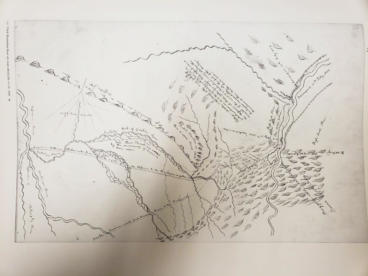
The goal to showcase the role of beaver as a keystone species in creating wetland habitat was inspired by Captain William Clark’s journal entry July 14, 1806. There has been much discussion on how Clark’s journal entry implies the Gallatin Valley was thick with beaver dams and multiple threaded river channels, making it impassable by boat. What is notable are his last words of the day, “much beaver Sign &c. Camped.”
This Clark-Maxamillian Map was drawn by Prince Maxamillian around 1810, four years after the completion of the Lewis and Clark Expedition. The map was made from Clark’s notes, sketch maps and other information provided by Clark. The area in the center with all the braided river channels is the main and east fork of the Gallatin River.
Bozeman History
The city of Bozeman was founded in August 1864 by John Bozeman, a frontiersman from Georgia who led wagon trains west to the gold fields in the Montana Territory along the Bozeman Trail – a cutoff of the Oregon Trail. The town served as a supply hub for prospectors looking to strike it rich in the nearby gold towns.

East Bozeman
This brief history was recorded during the development of the Village Downtown. The train spur shown in the historic image below is the current trail. Note the Story Hills in the background.

The Indrelands
The name “Indreland” means “in the land” in Norwegian. From the homeland in western Norway, Rasmus Indreland immigrated to Montana, joining a budding Norwegian community in the northern foothills of the Crazy Mountains where he filed a homestead claim in 1891. Rasmus and his wife Inger had 13 children who eventually scattered throughout the state.
After retiring from the Marine Corps in 1964, son Arnold, his wife Olga, and kids Matthew, Ileana, and Glenniss settled on a ranch on Cokedale Road, between Livingston and Bozeman. Arnold ranched with conservation in mind, from protecting water sources to using natural regeneration of hayland.
Ileana Indreland carried the rural work ethic and connection to the land into her successful real estate career. With husband Michael Delaney, they have completed numerous historic preservation and infill projects with a focus on downtown Bozeman.
When the Village Downtown started taking shape in 2002, they knew the wetlands to the east had the potential to be a natural sanctuary. Ileana and Mike felt the robust membership, expertise, and solid leadership of the Sacajawea Audubon Society made for the perfect partnership in restoring the wetland. On December 28, 2018 they gifted 32.4 acres to SAS, plus another seven+/- adjacent acres are in the process of being purchased. This 40-acre site has been designated the Indreland Audubon Wetland Preserve.
Ileana states, “Taking care of the land has always been a big part of my family heritage. What better way to leave a legacy for the future than to put this key property in the capable hands of Sacajawea Audubon Society for all to enjoy.”